Permafrost is a phenomenon of the subsurface thermal state and is defined as ground at or below the freezing point of water for two or more years.
Permafrost underlies approximately one quarter of the terrestrial Northern Hemisphere. From borehole temperature data and active layer depth measurements we know that over the past three decades permafrost has been warming, and continues to warm across the circumpolar North. Changing permafrost interacts with ecosystems and climate on various spatial and temporal scales. Environmental changes accelerate the microbial breakdown of organic carbon and the release of the greenhouse gases carbon dioxide and methane which can accelerate climate change. Monitoring across scales is required in order to quantify the changes of variations in this ECV.
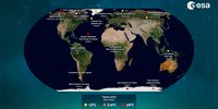
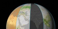
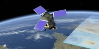
Permafrost cannot be directly detected from space, but many surface features of permafrost terrains and typical periglacial landforms are observable with a variety of EO sensors ranging from very high to medium resolution in various wavelengths. In addition, landscape dynamics associated with permafrost changes and geophysical variables relevant for characterising the state of permafrost, such as land surface temperature or snow-water equivalent, can be observed with space-based Earth Observation. Permafrost_CCI will provide for different epochs consistent global maps of the parameters permafrost temperature and active layer thickness based on Earth Observation records ingested into a permafrost model scheme.
Objective
The ultimate objective of Permafrost_CCI is to develop and deliver permafrost maps as ECV products primarily derived from satellite measurements. The required associated parameters by GCOS for the ECV Permafrost are “Depth of active layer (m)” and “Permafrost temperature (°C)”. Algorithms have been identified which can provide these parameters ingesting a set of global satellite data products (Land Surface Temperature (LST), Snow Water Equivalent (SWE), and landcover) in a permafrost model scheme that computes the ground thermal regime. In Permafrost_CCI we will strongly rely on data products from recent, ongoing and future ESA projects (e.g. LST_CCI, Snow_CCI), which offer consistency over several satellite generations. Validation and evaluation efforts comprise comparison to in-situ measurements of subsurface properties (active layer depth,active layer and permafrost temperatures, organic layer thickness, liquid water content in the active layer and permafrost) and surface properties (vegetation cover, snow depth, surface and air temperatures) as well as rock glacier inventories, local permafrost maps and geophysical survey measurements.
About the project
Permafrost_CCI will use the transient permafrost model CryoGrid 2, which was developed at the University of Oslo and has recently been demonstrated for North Siberia. Remotely sensed data sets of Land Surface Temperature (LST), Snow Water Equivalent (SWE) and landcover will be ingested in a permafrost model that computes the ground thermal regime over time for the production of consistent permafrost maps and active layer thickness at several epochs. We envision a target spatial scale between 10 and 1km and a temporal resolution of 1 month, which meets the requirements of the climate modelling community. Ensemble runs will be performed in order to take the subgrid variability into account and facilitate computing a permafrost probability for each pixel. In addition, ensemble methods can provide a measure of uncertainty, which will be developed and implemented together with users. The performance of the transient algorithm crucially depends on the representation of the ground properties, in particular ice and organic contents. We will compile a new ground stratigraphy product which is tailored to also suit the requirements of the global climate modelling community, thereby addressing a major shortcoming of the permafrost representation in climate models. In addition, the utilisation of freeze/thaw datasets for estimation of permafrost extent and temperature will be considered for round robin activities and especially evaluation of uncertainties in the permafrost transition zone. This approach is purely based on satellite measurements, but with comparably low spatial resolution and accuracy.
Within Permafrost_CCI we develop a hierarchical fully automatic processing scheme for the Permafrost ECVs. We will develop a modular production system for depth of active layer and permafrost temperature. The modular design allows extension of the system to support additional/new input data sources. Due to the very large data volumes to be processed, the algorithms will be implemented in a modern way to support distributed processing on multi-core cluster systems and production of intermediate products and of selected spatial tiles. The developed processing system is sustainable in the sense that it can later be exploited outside CCI e.g. within the C3S services.
At least four user case studies will be selected to demonstrate the value and impact of CCI Permafrost products for different aspects of climate research. The user case studies will consider climate models and local scale information from in-situ data and high resolution land cover maps.
Special emphasis is placed on validation via international and national permafrost monitoring networks and in cooperation with the permafrost community enhancing confidence in the validity of the CCI+Permafrost new maps of potential permafrost extent. We are currently assembling and adapting ground data from the Global Terrestrial Network for Permafrost GTN-P (WMO/GCOS) managed by the International Permafrost Association IPA [https://gtnp.arcticportal.org]. The validation and evaluation efforts will also innovatively consider high-mountain permafrost regions, using in-situ observations of ground temperatures, changes in subsurface ice and unfrozen water content, and velocities of permafrost creep, provided by national data-services such as PERMOS in Switzerland (http://www.permos.ch). The PERMOS data and the ESA GlobPermafrost rock glacier inventory will support the validation of CCI+ Permafrost products in mountain areas, where the CCI+ Permafrost products contain the highest uncertainties. This optimized and standardized validation data set will be supplied within the CCI+ Climate Research Data Package (CRDP) and will thus be publicly available for validation also for the broader climate science community.
Permafrost Climate Research Data Package on Ceda Archive and on the Climate Data Dashboard.
Permafrost version 5 dataset includes:
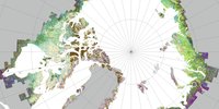
- Mean Annual Ground Temperature in permafrost areas v5.0, 1997-2023, 1km; 0m, 1m, 2m, 5m and 10 m depth (University Oslo); for the Northern Hemisphere: https://dx.doi.org/10.5285/5675b0be944f45a8af0e7ddbeb47a011; for Antarctica: https://dx.doi.org/10.5285/88380c00ad79414ab1a30d3cd4cb7ad9;
- Permafrost extent, v5.0, 1997-2023, 1km, fraction, annual (University Oslo); for the Northern Hemisphere: https://dx.doi.org/10.5285/d235665772ec4b558e9a89ac85595e71; for Antarctica: https://dx.doi.org/10.5285/25447c253cbe435b937347756fe47146;
- Permafrost active layer thickness, v5.0, 1997-2023 1 km, annual maximum thaw depth (University Oslo); for the Northern Hemisphere: https://dx.doi.org/10.5285/a6fbedd8ee5b472c8e84e55f746c1704; for Antarctica: https://dx.doi.org/10.5285/9580c512bb474d00b1e0ee554e219bb7.
Citation of complete dataset:
Westermann, S.; Barboux, C.; Bartsch, A.; Delaloye, R.; Grosse, G.; Heim, B.; Hugelius, G.; Irrgang, A.; Kääb, A.M.; Matthes, H.; Nitze, I.; Pellet, C.; Seifert, F.M.; Strozzi, T.; Wegmüller, U.; Wieczorek, M.; Wiesmann, A. (2025): ESA Permafrost Climate Change Initiative (Permafrost_cci): Permafrost version 4 data products. NERC EDS Centre for Environmental Data Analysis, date of citation. https://catalogue.ceda.ac.uk/uuid/c116848868054e18a9f5a51d68c3ad21.
Alternative access via WebGIS visualization at https://maps.awi.de.
Additional Permafrost_cci records:
- Rock glacier inventories at WebMAPS (University Fribourg).
- Circumpolar landcover units v2.0, north of treeline, Sentinel-1 and Sentinel-2 at https://doi.org/10.5281/zenodo.14235736 (b.geos, SU and AWI).
- Days with potential alteration of ground temperature through rain on snow: mid-winter (Nov-Feb) snow thaw and refreeze, north of 65°N, MetopASCAT + SMOS at https://zenodo.org/record/7575927 (b.geos and FMI).
Heritage:
- Global permafrost properties (probability and mean annual ground temperature) based on equilibrium modelling (TTOP, 2000-2016) from GlobPermafrost (https://globpermafrost.info/products-and-data-access).
The Permafrost consortium is based on a close collaboration between the following partners
- Gamma Remote Sensing and Consulting AG (GAMMA), Switzerland
- b.geos GmbH (B.GEOS), Austria
- Department of Geosciences of the University of Oslo (GUIO), Norway
- Alfred Wegener Institute Helmholtz Centre of Polar and Marine Research (AWI), Germany
- Geography Unit of the Department of Geosciences of the University of Fribourg (UNIFR), Switzerland
- Department of Physical Geography and Bolin Centre of Climate Research of Stockholm University (SU), Sweden
- Geography Department, West University of Timișoara (WUT), Romania
- TERRASIGNA, Bucharest, Romania
- Norwegian Research Centre (NORCE), Tromsø, Norway
- University Centre in Svalbard (UNIS), Norway
- Enveo IT GmbH (ENVEO), Austria
- Finnish Meteorological Institute (FMI), Finland
- Department of Biological Sciences, Geological and Environmental of the University of Bologna (UNIBO), Italy
Click on the following links for publications relating to the Permafrost project.
2026
Jones, C. E., Rosenqvist, A., Rommen, B., Fitrzyk, M., Rignot, E., Scheuchl, B., Zheng, Y., Hooper, A., Simons, M., Kobayashi, T., Siqueira, P., Santoro, M., Tadono, T., Hess, L., McNairn, H., Frulla, L., Johansson, M., Dierking, W., Rouyet, L., Bartsch, A., Lopez Dekker, P., and Johannessen, J. A.: Observation and Coordination Needs for Current, Near‐Future, and Next Generation Earth‐Observing SAR Systems, Earth and Space Science, 13, https://doi.org/10.1029/2025ea004868, 2026.
Bartsch, A., Widhalm, B., Radha Krishnan, S. R., and Liu, Z.: Tracking land surface deformation in lowland permafrost regions across the Arctic exploiting the first decade of Copernicus Sentinel-1, Remote Sensing of Environment, 340, 115409, https://doi.org/10.1016/j.rse.2026.115409, 2026.
Wendt, L., Rouyet, L., Christiansen, H. H., Lauknes, T. R., and Westermann, S.: InSAR sensitivity to active layer ground ice content in Adventdalen, Svalbard, The Cryosphere, 20, 1179–1197, https://doi.org/10.5194/tc-20-1179-2026, 2026.
Strozzi, T., Jones, N., Boike, J., Antonova, S., Heim, B., Leinss, S., Wegmüller, U., Westermann, S., Kääb, A., Grosse, G., and Bartsch, A.: Seasonal vertical surface thaw displacement in 2018 on Samoylov Island (Lena Delta, northeastern Siberia) measured by satellite SAR interferometry with X-, C- and L-band sensors, Remote Sensing of Environment, 335, 115293, 2026. https://doi.org/10.1016/j.rse.2026.115293.
2025
Bartsch, A., Tanguy, R., Bergstedt, H., von Baeckmann, C., Tømmervik, H., Macias-Fauria, M., Lemmetyinen, J., Rautiainen, K., Gruber, C., and Forbes, B. C.: Similarities between sea ice area variations and satellite-derived terrestrial biosphere and cryosphere parameters across the Arctic, The Cryosphere, 19, 4929–4967, 2025. https://doi.org/10.5194/tc-19-4929-2025.
Brardinoni, F., Vivero, S., Barboux, C., Bodin, X., Cicoira, A., Echelard, T., Hu, Y., Jones, N., Lambiel, C., MacDonell, S., Pellet, C., Rouyet, L., Ruiz, L., Schaffer, N., Wehbe, M., and Delaloye, R.: RGIK guidelines for compiling consistent rock glacier inventories, Geomorphology, 110050, 2025. https://doi.org/10.1016/j.geomorph.2025.110050.
Onaca, A., Sîrbu, F., Poncoş, V., Hilbich, C., Strozzi, T., Urdea, P., Popescu, R., Berzescu, O., Etzelmüller, B., Vespremeanu-Stroe, A., Vasile, M., Teleagă, D., Birtaş, D., Lopătiţă, I., Filhol, S., Hegyi, A., and Ardelean, F.: Slow-moving rock glaciers in marginal periglacial environment of Southern Carpathians, Earth Surf. Dynam., 13, 981–1001, 2025. https://doi.org/10.5194/esurf-13-981-2025.
Rouyet, L., Bolch, T., Brardinoni, F., Caduff, R., Cusicanqui, D., Darrow, M., Delaloye, R., Echelard, T., Lambiel, C., Pellet, C., Ruiz, L., Schmid, L., Sirbu, F., and Strozzi, T.: Rock Glacier Inventories (RoGIs) in 12 areas worldwide using a multi-operator consensus-based procedure, Earth Syst. Sci. Data, 17, 4125–4157, 2025. https://doi.org/10.5194/essd-17-4125-2025.
Brovkin, V., Bartsch, A., Hugelius, G., Calamita, E., Lever, J.J., Goo, E., Kim, H., Stacke, T., de Vrese, P.: Permafrost and Freshwater Systems in the Arctic as Tipping Elements of the Climate System. Surv Geophys, 2025. https://doi.org/10.1007/s10712-025-09885-9.
Frost GV, Bhatt US, Macander MJ, Berner LT, Walker DA, Raynolds MK, Magnússon RÍ, Bartsch A, Bjerke JW, Epstein HE, Forbes BC, Goetz SJ, Hoy EE, Karlsen SR, Kumpula T, Lantz TC, Lara MJ, López-Blanco E, Montesano PM, Neigh CSR, Nitze I, Orndahl KM, Park T, Phoenix GK, Rocha AV, Rogers BM, Schaepman-Strub G, Tømmervik H, Verdonen M, Veremeeva A, Virkkala A-M and Waigl CF: The changing face of the Arctic: four decades of greening and implications for tundra ecosystems. Front. Environ. Sci. 13:1525574, 2025. https://doi.org/10.3389/fenvs.2025.1525574.
Loriani, S., Bartsch, A., Calamita, E., Donges, J. F., Hebden, S., Hirota, M., Landolfi, A., Nagler, T., Sakschewski, B., Staal, A., Verbesselt, J., Winkelmann, R., Wood, R., Wunderling, N.: Monitoring the Multiple Stages of Climate Tipping Systems from Space: Do the GCOS Essential Climate Variables Meet the Needs? Surveys in Geophysics, 2025. https://doi.org/10.1007/s10712-024-09866-4.
Widhalm, B., Bartsch, A., Strozzi, T., Jones, N., Khomutov, A., Babkina, E., Leibman, M., Khairullin, R., Göckede, M., Bergstedt, H., von Baeckmann, C., and Muri, X.: InSAR-derived seasonal subsidence reflects spatial soil moisture patterns in Arctic lowland permafrost regions, The Cryosphere, 19, 1103–1133, https://doi.org/10.5194/tc-19-1103-2025, 2025.
Hu, Y., Arenson, L. U., Barboux, C., Bodin, X., Cicoira, A., Delaloye, R., Gärtner-Roer, I., Kääb, A., Kellerer-Pirklbauer, A., Lambiel, C., Liu, L., Pellet, C., Rouyet, L., Schoeneich, P., Seier, G., Strozzi, T.: Rock glacier velocity: An essential climate variable quantity for permafrost. Reviews of Geophysics, 63, e2024RG000847, 2025. https://doi.org/10.1029/2024RG000847.
Bartsch, A., Muri, X., Hetzenecker, M., Rautiainen, K., Bergstedt, H., Wuite, J., Nagler, T., and Nicolsky, D.: Benchmarking passive microwave satellite derived freeze/thaw datasets, The Cryosphere, 19, 459–483, 2025. https://doi.org/10.5194/tc-19-459-2025.
Streletskiy, D.A., Maslakov, A., Grosse, G., Shiklomanov, N., Farquharson, L.M., Zwieback, S., Iwahana, G., Bartsch, A., Liu, L., Strozzi, T., Lee, H., Debolskiy, M. V.: Thawing permafrost is subsiding in the Northern Hemisphere - review and perspectives. Environmental Research Letters, Volume 20, Number 1, 2025. https://doi.org/10.1088/1748-9326/ada2ff.
2024
Tanguy, R., Bartsch, A., Nitze, I., Irrgang, A., Petzold, P., Widhalm, B., von Baeckmann, C., Boike, J., Martin, J., Efimova, A., Vieira, G., Whalen, D., Heim, B., Wieszorek, M., Grosse, G.: Pan‐Arctic Assessment of Coastal Settlements and Infrastructure Vulnerable to Coastal Erosion, Sea‐Level Rise, and Permafrost Thaw, Earth’s Future, 2024. https://doi.org/10.1029/2024EF005013.
Burn, C., Bartsch, A., Chakraborty, E., Das, S., Frauenfelder, R., Gärtner-Roer, I., Gisnås, K., Herring, T., Jones, B., Kokelj, S., Langer, M., Lathrop, E., Murton, J., Nielsen, D., Niu, F., Olson, C., O'Neill, H. ., Opfergelt, S., Overduin, P., Schaefer, K., Schuur, E. ., Skierszkan, E., Smith, S., Stuenzi, S., Tank, S., van der Sluijs, J., Vieira, G., Westermann, S., Wolfe, S. and Yarmak, E.: Developments in Permafrost Science and Engineering in Response to Climate Warming in Circumpolar and High Mountain Regions, 2019–2024. Permafrost and Periglac Process, 2024. https://doi.org/10.1002/ppp.2261.
von Baeckmann, C., Bartsch, A., Bergstedt, H., Efimova, A., Widhalm, B., Ehrich, D., Kumpula, T., Sokolov, A., and Abdulmanova, S.: Land cover succession for recently drained lakes in permafrost on the Yamal Peninsula, Western Siberia, The Cryosphere, 18, 4703–4722, 2024. https://doi.org/10.5194/tc-18-4703-2024.
Schickhoff, M., de Vrese, P., Bartsch, A., Widhalm, B. and Brovkin, V.: Effects of land surface model resolution on fluxes and soil state in the Arctic, Environ. Res. Lett. 19 104032, 2024. https://doi.org/10.1088/1748-9326/ad6019.
Bertone, A., Jones, N., Mair, V., Scotti, R., Strozzi, T., and Brardinoni, F.: A climate-driven, altitudinal transition in rock glacier dynamics detected through integration of geomorphological mapping and synthetic aperture radar interferometry (InSAR)-based kinematics, The Cryosphere, 18, 2335–2356, 2024. https://doi.org/10.5194/tc-18-2335-2024.
Ishikawa, M., Westermann, S., Jambaljav, Y., Dashtseren, A., Hiyama, T., Endo, N., & Etzelmüller, B. (2024), Transient Modeling of Permafrost Distribution From 1986 to 2016 in Mongolia. Permafrost and Periglac Process, 2024. https://doi.org/10.1002/ppp.2231.
Zwieback, S., Liu, L., Rouyet, L., Short, N. and Strozzi, T., Advances in InSAR Analysis of Permafrost Terrain. Permafrost and Periglac Process, 2024. https://doi.org/10.1002/ppp.2248.
Kääb, A., Røste, J. Rock glaciers across the United States predominantly accelerate coincident with rise in air temperatures. Nat Commun 15, 7581, 2024. https://doi.org/10.1038/s41467-024-52093-z.
Sasgen, I., Steinhoefel, G., Kasprzyk, C., Matthes, H., Westermann, S., Boike, J., Grosse, G.: Atmosphere circulation patterns synchronize pan-Arctic glacier melt and permafrost thaw, Commun Earth Environ, 5, 375, 2024. https://doi.org/10.1038/s43247-024-01548-8.
Bartsch, A., Efimova, A., Widhalm, B., Muri, X., von Baeckmann, C., Bergstedt, H., Ermokhina, K., Hugelius, G., Heim, B., and Leibman, M.: Circumarctic land cover diversity considering wetness gradients, Hydrol. Earth Syst. Sci., 28, 2421–2481, 2024. https://doi.org/10.5194/hess-28-2421-2024.
Nitzbon, J., Schneider von Deimling, T., Aliyeva, M., Chadburn, S., Grosse, G., Laboor, S., Lee, H., Lohmann, G., Steinert, N., Stuenzi, S., Werner, M., Westermann, S., and Langer M.: No respite from permafrost-thaw impacts in the absence of a global tipping point, Nat. Clim. Chang, 2024. https://doi.org/10.1038/s41558-024-02011-4.
Lenton, T.M., Abrams, J.F., Bartsch, A. et al.: Remotely sensing potential climate change tipping points across scales. Nature Communications, 15, 343, 2024. https://doi.org/10.1038/s41467-023-44609-w.
2023
Westermann, S., Ingeman-Nielsen, T., Scheer, J., Aalstad, K., Aga, J., Chaudhary, N., Etzelmüller, B., Filhol, S., Kääb, A., Renette, C., Schmidt, L. S., Schuler, T. V., Zweigel, R. B., Martin, L., Morard, S., Ben-Asher, M., Angelopoulos, M., Boike, J., Groenke, B., Miesner, F., Nitzbon, J., Overduin, P., Stuenzi, S. M., and Langer, M.: The CryoGrid community model (version 1.0) – a multi-physics toolbox for climate-driven simulations in the terrestrial cryosphere, Geosci. Model Dev., 16, 2607–2647, 2023.. https://doi.org/10.5194/gmd-16-2607-2023.
Aga, J., Boike, J., Langer, M., Ingeman-Nielsen, T., and Westermann, S.: Simulating ice segregation and thaw consolidation in permafrost environments with the CryoGrid community model, The Cryosphere, 17, 4179–4206, 2023. https://doi.org/10.5194/tc-17-4179-2023.
Renette, C., Aalstad, K., Aga, J., Zweigel, R. B., Etzelmüller, B., Lilleøren, K. S., Isaksen, K., and Westermann, S.: Simulating the effect of subsurface drainage on the thermal regime and ground ice in blocky terrain in Norway, Earth Surf. Dynam., 11, 33–50, 2023.. https://doi.org/10.5194/esurf-11-33-2023.
Langer, M., von Deimling, T.S., Westermann, S., Rolph, R., Rutte, R., Antonova, S., Rachold, V., Schultz, M., Oehme A., Grosse G. Thawing permafrost poses environmental threat to thousands of sites with legacy industrial contamination. Nat Commun 14, 1721 (2023). https://doi.org/10.1038/s41467-023-37276-4.
Lambiel, C., Strozzi, T., Paillex, N., Vivero, S. and Jones, N.: Inventory and kinematics of active and transitional rock glaciers in the Southern Alps of New Zealand from Sentinel-1 InSAR, Arctic, Antarctic, and Alpine Research, 55:1, 2183999, 2023. https://doi.org/10.1080/15230430.2023.2183999.
Bartsch, A., Strozzi, T., and Nitze, I.: Permafrost Monitoring from Space, Surveys in Geophysics, 2023. https://link.springer.com/article/10.1007/s10712-023-09770-3.
Bartsch, A., Bergstedt, H., Pointner, G., Muri, X., Rautiainen, K., Leppänen, L., Joly, K., Sokolov, A., Orekhov, P., Ehrich, D., and Soininen, E. M.: Towards long-term records of rain-on-snow events across the Arctic from satellite data, The Cryosphere, 17, 889–915, 2023. https://doi.org/10.5194/tc-17-889-2023.
2022
Lilleøren, K. S., Etzelmüller, B., Rouyet, L., Eiken, T., Slinde, G., and Hilbich, C.: Transitional rock glaciers at sea level in northern Norway, Earth Surf. Dynam., 10, 975–996, 2022. https://doi.org/10.5194/esurf-10-975-2022.
Bertone, A., Barboux, C., Bodin, X., Bolch, T., Brardinoni, F., Caduff, R., Christiansen, H. H., Darrow, M., Delaloye, R., Etzelmüller, B., Humlum, O., Lambiel, C., Lilleøren, K. S., Mair, V., Pellegrinon, G., Rouyet, L., Ruiz, L., and Strozzi, T (2022).: Incorporating InSAR kinematics into rock glacier inventories: insights from 11 regions worldwide , The Cryosphere, 16, 2769–2792, 2022, https://doi.org/10.5194/tc-16-2769-2022.
Miner, K., Turestky, M., Malina, E., Bartsch, A., Tamminen, J., McGuire, A.D., Fix, A., Sweeney, C., Elder, C.D., and Miller, C.E. (2022): Permafrost carbon emissions in a changing Arctic, Nature Reviews Earth & Environment, 3, 55–67. https://doi.org/10.1038/s43017-021-00230-3.
2021
Rouyet, L., Lilleøren, K.S., Böhme, M., Vick, L.M., Delaloye, R., Etzelmüller, B., Lauknes, T.R., Larsen, Y., and Blikra, L.H. (2021): Regional Morpho-Kinematic Inventory of Slope Movements in Northern Norway, Front. Earth Sci. 9:6810881, https://doi.org/10.3389/feart.2021.681088.
Bartsch, A., Pointner, G., Nitze, I., Efimova, A., Jakober, D., Ley, S., Högström, E., Grosse, G., and Schweitzer, P. (2021): Expanding infrastructure and growing anthropogenic impacts along Arctic coasts, Environmental Research Letters, Volume 16, Number 11, https://doi.org/10.1088/1748-9326/ac3176.
Nitze, I, Heidler, K., Barth, S., and Grosse, G. (2021): Developing and testing a deep learning approach for mapping retrogressive thaw slumps. Remote Sensing, 13(21), 4294, https://doi.org/10.3390/rs13214294.
A. Bartsch, G. Pointner, H. Bergstedt, B. Widhalm, A. Wendleder and A. Roth (2021) : Utility of Polarizations Available from Sentinel-1 for Tundra Mapping, IEEE International Geoscience and Remote Sensing Symposium IGARSS, 2021, pp. 1452-1455, https://doi.org/10.1109/IGARSS47720.2021.9553993.
Rouyet, L., Liu, L., Strand, S.M., Christiansen, H.H., Lauknes, T.R., Larsen, Y. (2021): Seasonal InSAR Displacements Documenting the Active Layer Freeze and Thaw Progression in Central-Western Spitsbergen, Svalbard, Remote Sensing, 13(15), 2977, https://doi.org/10.3390/rs13152977.
Martin, L. C. P., Nitzbon, J., Scheer, J., Aas, K.S., Eiken, T., Langer, M., Filhol, S., Etzelmüller, B. and Westermann, S. (2021), Lateral thermokarst patterns in permafrost peat plateaus in northern Norway, The Cryosphere, 15, 3423–3442, https://doi.org/10.5194/tc-15-3423-2021.
Obu, J. (2021): How much of the Earth’s surface is underlain by permafrost?, Journal of Geophysical Research: Earth Surface, 126, e2021JF006123, https://doi.org/10.1029/2021JF006123.
Kääb, A., Strozzi, T., Bolch, T., Caduff, R., Trefall, H., Stoffel, M., and Kokarev, A. (2021): Inventory, motion and acceleration of rock glaciers in Ile Alatau and Kungöy Ala-Too, northern Tien Shan, since the 1950s, The Cryosphere, 15, 927–949, https://doi.org/10.5194/tc-15-927-2021.
A. Veremeeva, I. Nitze, F. Günther, G. Grosse and E. Rivkina (2021) : Geomorphological and Climatic Drivers of Thermokarst Lake Area Increase Trend (1999–2018) in the Kolyma Lowland Yedoma Region, North-Eastern Siberia, Remote Sensing, 13(2), 178, https://doi.org/10.3390/rs13020178.
2020
B.M. Jones, A.M. Irrgang, L.M. Farquharson, H. Lantuit, D. Whalen, S. Ogorodov, M. Grigoriev, C. Tweedie, A.E. Gibbs, M.C. Strzelecki, A. Baranskaya, N. Belova, A. Sinitsyn, A. Kroon, A. Maslakov, G. Vieira, G. Grosse, P. Overduin, I. Nitze, C. Maio, J. Overbeck, M. Bendixen, P. Zagórski and V.E. Romanovsky (2020) : Coastal Permafrost Erosion, NOAA Arctic Report Card, https://doi.org/10.25923/e47w-dw52.
Nitze, I., Cooley, S. W., Duguay, C. R., Jones, B. M., and Grosse, G. (2020): The catastrophic thermokarst lake drainage events of 2018 in northwestern Alaska: fast-forward into the future, The Cryosphere, 14, 4279–4297, https://doi.org/10.5194/tc-14-4279-2020.
Burke, E.J., Zhang, Y., Krinner, G. (2020): Evaluating permafrost physics in the Coupled Model Intercomparison Project 6 (CMIP6) models and their sensitivity to climate change, The Cryosphere, 14, 3155–3174, https://doi.org/10.5194/tc-14-3155-2020.
Swingedouw, D., Speranza, C., Bartsch, A., Durand, G., Jamet, C., Beaugrand, G., Conversi, A. (2020): Early Warning from Space for a Few Key Tipping Points in Physical, Biological, and Social-Ecological Systems. Surveys in Geophysics. https://doi.org/10.1007/s10712-020-09604-6
Lissak, C., Bartsch, A., De Michele, M. et al. Remote Sensing for Assessing Landslides and Associated Hazards. Surv Geophys (2020). https://doi.org/10.1007/s10712-020-09609-1
Bartsch A, Ley S, Nitze I, Pointner G and Vieira G (2020), Feasibility Study for the Application of Synthetic Aperture Radar for Coastal Erosion Rate Quantification Across the Arctic. Front. Environ. Sci. 8:143. doi: 10.3389/fenvs.2020.00143. https://www.frontiersin.org/articles/10.3389/fenvs.2020.00143/full
T. Popp, M.I. Hegglin, R. Hollmann, F. Ardhuin, A. Bartsch, A. Bastos, V. Bennett, J. Boutin, C. Brockmann, M. Buchwitz, E. Chuvieco, P. Ciais, W. Dorigo, D. Ghent, R. Jones, T. Lavergne, C.J. Merchant, B.Meyssignac, F. Paul, S. Quegan, S. Sathyendranath, T. Scanlon, M. Schröder, S.G.H. Simis, U. Willén (2020): Consistency of satellite climate data records for Earth system monitoring. Bulletin of the American Meteorological Society 1–68, doi.org/10.1175/BAMS-D-19-0127.1.
Bergstedt, H., Bartsch, A., Duguay, C., Jones, B. (2020): Influence of surface water on coarse resolution C-band backscatter: Implications for freeze/thaw retrieval from scatterometer data. Remote Sensing of Environment, Volume 247, 15 September 2020, https://doi.org/10.1016/j.rse.2020.111911.
Bergstedt H., A. Bartsch, A. Neureiter, A. Höfler, B. Widhalm, N. Pepin and J. Hjort (2020): Deriving a Frozen Area Fraction From Metop ASCAT Backscatter Based on Sentinel-1, IEEE Transactions on Geoscience and Remote Sensing, vol. 58, no. 9, pp. 6008-6019, https://doi.org/10.1109/TGRS.2020.2967364.
Strozzi T., R.Caduff, N. Jones, C. Barboux, R, Delaloye, X. Bodin, A. Kääb, E. Mätzler, L. Schrott (2020): Monitoring Rock Glacier Kinematics with Synthetic Aperture Radar. Remote Sensing, 12(3), 559.
Obu J., S. Westermann, G. Vieira, A. Abramov, M.R. Balks, A. Bartsch, F. Hrbáček, A. Kääb, M. Ramos (2020): Pan-Antarctic map of near-surface permafrost temperatures at 1 km2 scale. The Cryosphere, 14, 497-519.
Bartsch A., B. Widhalm, M. Leibman, K. Ermokhina, T. Kumpula, A. Skarin, E.J. Wilcox, B.M. Jones, G. V. Frost, A. Höfler, G. Pointner (2020) Feasibility of tundra vegetation height retrieval from Sentinel-1 and Sentinel-2 data. Remote Sensing of Environment, 237, 111515.
2019
Turetsky MR, Abbott BW, Jones MC, Walter Anthony K, Olefeldt D, Schuur EAG, Koven C, McGuire AD, Grosse G, Kuhry P, Hugelius G, Lawrence DM, Gibson C, Sannel ABK (2019): Permafrost collapse is accelerating carbon release. Nature, 569, 32-34. doi: 10.1038/d41586-019-01313-4.
L. Rouyet, T. R. Lauknes, H. H. Christiansen, S. M. Strand and Y. Larsen (2019): Seasonal dynamics of a permafrost landscape, Adventdalen, Svalbard, investigated by InSAR. Remote Sensing of Environment, Volume 231, 15 September 2019, 111236.
J. Obu, S. Westermann, A. Bartsch, N. Berdnikov, H.H. Christiansen, A. Dashtseren, R. Delaloye, B. Elberling, B. Etzelmüller, A. Kholodov, A. Khomutov, A. Kääb, M.O. Leibman, A.G. Lewkowicz, S.K. Panda, V. Romanovsky, R.G. Way, A. Westergaard-Nielsen, T. Wu, J. Yamkhin, D. Zou (2019). Northern Hemisphere permafrost map based on TTOP modelling for 2000-2016 at 1 km2 scale. Earth-Science Reviews, Volume 193, Pages 299-316.
2017
A. Trofaier, S. Westermann & A. Bartsch (2017). Progress in space-borne studies of permafrost for climate science: Towards a multi-ECV approach. Remote Sensing of Environment, Volume 203, Pages 55-70.
IPA Action Group : Rock glacier inventories and kinematics
The IPA Action Group (2018-2022) intends to sustain the first steps toward the organization and the management of a network dedicated to rock glacier mapping (inventorying) and to promote the integration of permafrost creep rate (rock glacier kinematics) as a new associated parameter to Essential Climate Variable (ECV) Permafrost within the Global Climate Observing System (GCOS) initiative supported by the World Meteorological Organization (WMO), characterizing the evolution of mountain permafrost on the global scale.
The European Space Agency has launched the GlobPermafrost initiative (2016-2019) to develop, validate and implement information products to support the research communities and related international organisations like IPA and CliC in their work on understanding permafrost better by integration of Earth Observation data. The GlobPermafrost project is a follow up to the DUE Permafrost project. Further developments regarding permafrost modelling are made within the ESA CCI+ Permafrost project (2018-2021).
The following links provide supporting graphics and animations relating to the Permafrost project:
Permafrost Mean Annual Ground Temperature:
https://www.youtube.com/watch?v=vL6hh9IpANk
Change in the Arctic:
https://www.esa.int/ESA_Multimedia/Videos/2021/09/Change_in_the_Arctic
/
2nd User Workshop of the ESA CCI Permafrost Phase 2 Project
Virtual Meeting Wednesday 4 June 2025 09:00-12:00
Background
Within the European Space Agency (ESA), the Climate Change Initiative (CCI) is a global monitoring program started in 2008 which aims to provide long-term satellite-based products to serve the climate modeling and climate user community. Permafrost has been selected as one of the Essential Climate Variables (ECVs) which were elaborated during Phase 1 of the ESA CCI continuation program CCI+ (2018-2021) and continued during Phase 2 of CCI+ (2022-2025). During Permafrost_cci Phase 1, the two main quantities associated to the ECV Permafrost were Ground Temperature (GT) and Active Layer Thickness (ALT). Following the 2022 GCOS (Global Climate Observing System) Implementation Plan, GT and ALT are complemented in Phase 2 by a new ECV Permafrost quantity, i.e., Rock Glacier Velocity (RGV). Further auxiliary generated datasets include circumpolar land cover and rain on snow events.
Objectives
The focus of the 2nd User Workshop of the ESA CCI Permafrost Phase 2 Project was on assessing the usefulness of all the data produced during Phases 1 and 2.
Agenda and presentations
Project overview
- 9:00 Introduction to the project and datasets (Tazio Strozzi, Gamma Remote Sensing / Annett Bartsch, b.geos)
- 9:10 Data generation with CryoGRID – overview (Sebastian Westermann, UIO)
- 9:20 Evaluation of CryoGRID results (Birgit Heim, AWI)
- 9:30 Rock glacier inventory generation and status (Line Rouyet, NORCE)
User presentations part 1
- 9:45 Supporting snow modelling with Permafrost_CCI data (Heidrun Mathes, AWI)
- 9:55 Pan-Arctic thaw and melt: insights from ESA Permafrost_CCI and GRACE/-FO satellite gravimetry (Ingo Sasgen, AWI)
- 10:05 Changes in the composition of nitrogen yields in large Arctic rivers linked to temperature and precipitation (Bridger Ruyle, NYU)
- 10:15-10:30 Discussion
User presentations part 2
- 10:45 Validation of Active Layer Thaw Depth and Related Parameters for EO4PAC (Julia Boike, AWI)
- 10:55 Integrating S1 and CSK InSAR-based information for an improved regional characterization of rock glacier dynamics (F. Brardinoni & T. Echelard, UniBo)
- 11:05 A transdisciplinary study on key risks from Arctic permafrost thaw (Johanna Scheer, UMU)
- 11:15 Monitoring high-altitude permafrost in the Dry Andes (Sebastian Felipe Ruiz Pereira, UC)
- 11:35- 12:00 Discussion and feedback
Participants
Around 40 people registered and participated in the workshop.
Workshop summary
After the welcome, the general context of the project and the data produced during Phases 1 and 2 (“Baseline” plus “Options”) were presented. Primary deliverables are so-called Climate Research Data Packages (CRDP, now Version 3), including Ground Temperature (GT), Active Layer Thickness (ALT) and permafrost extent. In addition, in-situ borehole temperature records were harmonized for calibration and validation. RGV has been integrated as a new associated quantity in 2022 and in Phase 2 we support the production of standardized Rock Glacier Inventories (RoGI) and we are making a significant contribution to develop RGV based on remote sensing, in particular InSAR. New circumarctic landcover units at 10 m resolution now supports the CryoGRID soil parameterization. Data and documentation are available on the project website and there are tools available for data visualization.
Three internal project presentations were held in the following, describing data generation with CryoGRID, the evaluation of the CryoGRID results, and rock glacier inventory generation and status. Three user presentations were then given in a first session describing different uses of permafrost CCI data, spanning all CryoGROD product types. They included support to snow modelling, satellite gravimetry compared to pan-Arctic ALT trends, and a study on changes in the composition of nitrogen yields in large Arctic rivers linked to permafrost extent. Four user presentations were subsequently held in a second session with a broader perspective. They included independent validation of active layer thaw depth, recommendations for improved regional characterization of rock glacier dynamics, a study on key risks from Arctic permafrost thaw for local communities, and high-altitude permafrost in the Dry Andes. In each of the two sessions, the possible uses of CCI_data were discussed and recommendations collected.
Workshop outcome and recommendations
It was emphasized that the uncertainties in the products need to be clearly communicated as they affect the interpretation, especially in the case of permafrost extent maps. Spatial and temporal variability must be taken into account during validation to ensure robustness. Higher resolution products are of great interest. However, the small-scale variability of groundwater, snowpack, stratigraphy and land use is difficult to document. The presence of peat soils is crucial, which is particularly problematic in forested areas. The need for coverage of the southern hemisphere has been expressed. The participants exchanged experiences with the use of the data.
/
2024 ITCH – It’s The CryoGrid Hackathon
21-25 Oct 2024 | Tollboden and Biologen Drøbak | Oslo, Norway
Background
The CryoGrid permafrost models were initiated more than 10 years ago by the University of Oslo and have seen a constant development since then. In 2019, the developers started to merge different model branches into a new community model which has since then being steadily expanded and is currently used by more than 50 researchers worldwide. While initially conceived as a permafrost model, the new CryoGrid community model is also capable of simulating glacier and other cryosphere ECVs. Since 2020, algorithm development in the Permafrost_cci project focused on integrating the permafrost ECV processing chain (delivering ground temperature, permafrost extent and active layer thickness) into the CryoGrid community model which since 2023 has become the backbone of ECV processing in Permafrost_cci. At the same time, this integration has made many powerful elements of the Permafrost_cci processing chain available to the wider CryoGrid user community, thus opening for common model development and unlocking novel applications and spin-off projects. The CryoGrid user community gathers every year in a hackathon-style workshop which is called the ITCH - It's The CryoGrid Hackathon. The ITCH has been held annually since 2018 with an increasing number of participants and institutions. Its main target is to provide a platform to develop and share ideas, discuss directions of model development and coordinate activities within the user community.
Workshop overview
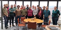
From Oct 21-25,2024, the 7th ITCH modeling workshop was held in Drøbak near Oslo, Norway. This year, topics related to remote sensing and possible applications within ESA-related projects were put in the foreground. Specifically, we conducted group work on using novel machine learning techniques to transfer the results of physically-based permafrost models in space which holds significant potential to speed up permafrost mapping, as well as to improve the spatial resolution of the resulting maps. The ITCH 2024 started with a two-day seminar held at Drøbak aquarium in which participants introduced themselves and their research interest, followed by presentations of newly funded projects using CryoGrid. In the final three days of the workshop, participants worked in groups “hackathon-style” on research topics of interest, putting practical advances of model codes and science applications in the foreground. In total 32, researchers (mainly in PostDoc/ PhD stage) from 13 institutions in 7 countries participated at the ITCH 2024 (see full participant list in the Appendix). The gender ratio of the participants was in balance (17 women, 15 men).
The ITCH was organized by the University of Oslo at the premises of the biological station in Drøbak, Norway, located right on the shore of Oslofjord about 25 km from Oslo. The biological station consists of two buildings: first the research unit “Biologen” located in a historic bulding with adjacent private harbour and second the historic toll collecting station “Tollboden” which today houses laboratories for student education and a conference center. In total, the station provides accommodation for up to 24 participants at a modest price. At the same time, it is possible for participants to cook themselves, thus greatly reducing the cost of the stay and making it possible to attend for students on a small budget. As the number of registered participants at the ITCH exceeded the capacity of the meeting room at the station, a larger meeting room was rented at the facilities of the local aquarium for the first two days.
Workshop program
Monday 12.00-13.30: extended lunch (Aquarium)
Monday 13.30-16.30: Introduction of participant activities (Aquarium)
Monday 16.30 - : Tour to Biologen and BBQ/icebreaker at the harbor
Tuesday 9.30-17.00: Presentations of new projects and discussions on past and future CryoGrid development (Akvarium)
-Sebastian Westermann: Updates on CryoGrid development with focus on spatial modeling
-Mike Angelopolous: Cryopegs and saline permafrost on Svalbard
-Jan Nitzbon: Towards simulating excess ice buildup in CryoGrid
-Brian Groenke: Synthetic model forcing from weather generators
-Simone Stuenzi: Modeling permafrost under forest in CryoGrid
-Tamara Mathys/Luke Gregor: High-resolution permafrost mapping in Central Asia using machine learning
-Tomasz Gluzinski: Improving subsurface parameters by assimilating geophysics data
-Mehriban Aliyeva: Contaminant mobilization from mudsumps in N Canada
-Roger Creel: Accounting for sea level and crustal rebound dynamics in subsea permafrost modeling
Wednesday morning: work in groups (Tollboden) – ESA Fellow Kristoffer Aalstad: combining machine learning with physically-based CryoGrid modeling
Wednesday afternoon - Friday 12.00: work in groups (Tollboden) - different topics
-spatial model runs, clustering
-model forcing downscaling and bias correction
-data assimilation
-vegetation representations in CryoGrid
-infrastructure
-future development for tracer advection and saline permafrost
-glacier applications of CryoGrid
Friday 12.00-13.00: lunch and end of ITCH (Tollboden)
Major advances and highlights
→ ESA Fellow Kristoffer Aalstad initiated and led group work on machine learning based in his work in the ESA fellowship “Probabilistic reAnalysis of the Terrestrial Cryosphere by History-matching using Evidence from Satellites (PATCHES)” and the ERC AdG GLACMASS. The main idea is to replace parts of the time-demanding physically-based modeling by machine learning which can potentially speed up calculations by one to two orders of magnitude.
→ Universal workflow for forcing data processing and bias-correction with local measurements based on the work in Permafrost_cci: This workflow forms the basis for several funded user projects which target high-resolution permafrost simulations in mountainous regions and Antarctica. It is partly based on the Permafrost_cci processing chain.
→ New target group on modeling solute advection/diffusion in permafrost systems, with focus on saline permafrost processes and thaw-induced contaminant mobilization. The group will work together to expand the simulation capabilities of saline permafrost. More general, it will establish tools to track solute flow in permafrost environments, both vertically and laterally. Several funded projects (EU, ESA, national funding) will pool resources for joint developments in CryoGrid.
→ New initiative on simulating ground ice accumulation with semi-empirical modeling approaches: This can potentially serve as model initialization in future Permafrost_cci ECV processing, thus enabling the simulation of ground ice melt, surface subsidence and potentially thermokarst in the future.
Key messages and recommendations
→ The ITCH has established itself as a meeting platform for the European permafrost modeling community. It is mainly driven by early-career researchers who have adopted the CryoGrid community model as a joint simulation tool for their research.
→ The CryoGrid community model has become a well-used platform to merge and process a range of data sets for cryosphere applications, most notably remote sensing and reanalysis data. Methodology and model code developed in the ESA Permafrost_cci project have strongly boosted the model’s capabilities for spatially distributed processing which has already now attracted a growing user community with several newly funded projects.
→ Development and maintenance of the CryoGrid community model is fully dependent on soft-money, such as ESA Permafrost_cci. Maintenance and user support is almost entirely accomplished by researchers and students at the University of Oslo on project basis - there is no base funding (e.g. for technicians, programmers, data scientists) available that would ensure sustainable operations on a long-term basis. Despite the current successes, this puts the CryoGrid community model and its user community in a volatile situation.
/
2024 European Polar Science Week
3 - 6 September 2024 | The Black Diamond | Copenhagen, Denmark
Background
The 2024 European Polar Science Week was an important milestone in the cooperation between the European Commission and the European Space Agency. The event took place from 3 to 6 September, 2024, in Copenhagen. The overall objective of the European Polar Science Week was to bring together the European polar science community and reinforce European cooperation for polar science. More specifically, the 2nd Polar Science Week aimed to:
- Share latest results in polar science with a focus on Earth observation, and promote networking and collaborative research in polar sciences, bringing together different expertise, data, and resources in a systemic manner;
- Identify major polar scientific challenges, observation gaps and research needs for the coming years;
- Formulate recommendations for a Polar Science Agenda, in particular with regard to maximising synergies between the ESA and Horizon Europe Programme;
- Develop and provide policy relevant recommendations.
Session Title: Space-borne studies of permafrost in the Arctic
Chairs: Tazio Strozzi and Annett Bartch
Date and Time: Thursday 5 September 2024 16:30 – 18:00
Session overview
Permafrost is a phenomenon of the subsurface thermal state and is defined as ground at or below the freezing point of water for two or more years. Permafrost underlies approximately one quarter of the terrestrial Northern Hemisphere. Permafrost is also an Essential Climate Variable (ECV) in the Global Climate Observing System (GCOS), which is characterized by subsurface temperatures, the depth of the seasonal thaw layer and, newly, rock glacier velocity. From borehole temperature data and active layer depth measurements, we know that over the past three decades permafrost has been warming, and continues to warm, across the circumpolar North. Changing permafrost interacts with ecosystems and climate on various spatial and temporal scales. Environmental changes accelerate the microbial breakdown of organic carbon and the release of the greenhouse gases carbon dioxide and methane, what can accelerate climate change. Monitoring across scales is required in order to quantify the changes of variations, which is challenging for in-situ data alone.
Permafrost cannot be directly detected from space, but many surface features of permafrost terrains and typical periglacial landforms are observable with a variety of Earth Observation (EO) sensors ranging from very high to medium resolution in various wavelengths. In addition, landscape dynamics associated with permafrost changes and geophysical variables relevant for characterizing the state of permafrost can be observed with space-based EO. The ESA’s CCI Permafrost project primarily provides for the period 1990-2021 consistent global maps at a spatial resolution of 1km of the parameters permafrost temperature and active layer thickness based on EO records (land surface temperature and landcover), reanalysis data (snow-water equivalent) and subsurface stratigraphy ingested into the transient permafrost model CryoGrid of the University of Oslo. Other thematic products available from EO data and investigated in ESA and other international projects include InSAR-based land subsidence maps and rock glacier kinematics, land surface properties and changes (e.g. freeze-thaw, landcover maps, retrogressive thaw slumps, fires), and ground-fast lake ice.
Summary of session presentations and discussion
In the session we discussed the general requirements for ground temperature modelling and validation and presented various results obtained from space-borne studies of permafrost in the Arctic. Six presentations documented the rapid advances in permafrost studies from space, including modeling and in-situ observations:
→ Frederieke Miesner (Alfred Wegener Institute & University of Oslo), The CryoGrid community model and Permafrost_CCI results;
→ Birgit Heim (Alfred Wegener Institute), Validation of Permafrost_cci ground temperature and active layer time series using international and national permafrost monitoring networks;
→ Line Rouyet (NORCE Norwegian Research Centre), New ECV parameter Rock Glacier Velocity (RGV);
→ John Peter Merryman Boncori (Technical University of Denmark), Thaw-season InSAR surface displacements at Zackenberg, NE Greenland;
→ Annett Bartsch (B.GEOS), Landcover characterization for permafrost methane flux studies contributing to AMPAC;
→ Annett Bartsch (B.GEOS) for Philipp de Vrese (Max-Planck-Institut für Meteorologie), Land-surface modeling of Arctic permafrost regions - use of satellite observations in the ERC Synergy project Q-Arctic.
In the discussion we highlighted that validation of the Permafrost_cci Phase II products was successfully completed using international and national monitoring networks.
Major advances and highlights
→ Improved accuracy of CCI permafrost products “Ground temperature” and “Active Layer Thickness”.
→ “Rock glacier velocity” is a new product of ECV permafrost, rock glaciers predominantly accelerate with rise in air/ground temperature.
→ Seasonal and multi-year Sentinel-1 subsidence have the potential to deterministically determine subsurface properties.
→ Spatially and thematically detailed landcover information at full circumpolar extent provides advance for many permafrost related applications, including monitoring of thaw impacts and climate model development.
→ Climate data records from satellites are potentially of high value for climate models focusing on polar issues, but the high product uncertainties in this region remain an open issue.
Key messages and recommendations
→ Permafrost temperatures are steadily increasing across the Arctic, but uncertainties in estimation need to be reduced.
→ Cal/Val super-sites across all permafrost zones (continuous, discontinuous) dedicated to permafrost studies are needed.
→ Resume Sentinel-1 IWS acquisitions over Siberia asap (6 days are better than 12 days).
→ Consider Arctic permafrost areas as key regions in the planning of acquisitions of future missions (e.g. ROSE-L, NISAR, Harmony, …).
/
1st Permafrost_cci User Workshop of Phase 2
Saturday 17 June 2023, 9-18 h: IPA Action Group "Rock glacier inventories and kinematics (RGIK)" Workshop III
Sunday 18 June 2023, 10-12 h & Tuesday 20 June 2023, 7.30-8.30 h: CCI+ Permafrost tutorial – data access and use
Background
Within the European Space Agency (ESA), the Climate Change Initiative (CCI) is a global monitoring program which aims to provide long-term satellite-based products to serve the climate modeling and climate user community. Permafrost has been selected as one of the Essential Climate Variables (ECVs) which were elaborated during Phase 1 of CCI+ (2018-2021) and continued during Phase 2 of CCI+ (2022-2025). The two main products associated to the ECV Permafrost, Ground temperature (GT) and Active Layer Thickness (ALT), were the primary documented variables during Permafrost_CCI Phase 1 (2018–2021). Following the 2022 GCOS (Global Climate Observing System) Implementation Plan, GT and ALT are complemented by a new ECV Permafrost product: Rock Glacier Velocity (RGV).
Objectives
A series of workshops were organized during the 6th European Conference on Permafrost (EUCOP 2023) in Puigcerdà (Spain). The two tutorials of Sunday 18 June 2023 between 10 and 12 h and of Tuesday 20 June 2023 between 7.30 and 8.30 h focused on the access and use of the data generated in Phase 1 of the project, i.e. Ground Temperature, Active Layer Thickness and Permafrost Extent. The workshop of Saturday 17 June 2023 between 9 and 18 was organized by the IPA Action Group "Rock glacier inventories and kinematics" (RGIK) to discuss the background, current status, challenges and future needs of Rock glacier inventories (RoGI) and Rock glacier velocity (RGV).
CCI+ Permafrost tutorial – data access and use
Agenda Sunday 18 June 2023
10.00 Introduction to the project and results
10.20 Tutorial on data access and visualization
10.50 Excericises by participants
12.00 End of meeting
Agenda Tuesday 20 June 2023
07.30 Introduction to the project and results
07.50 Tutorial on data access and visualization
08.20 Excericises by participants
08.30 End of meeting
List of presentations
ESA CCI+ Permafrost – data access and use
Workshop summary
A variety of options for Permafrost_cci datasets has been presented. This included data download as well as visualisation tools. As most of the target audience had an interest in specific regions, subsetting and location specific information retrieval was demonstrated for preselected regions as well as sites proposed by the participants. The introduction to the project and datasets also included some first higher level products (time series for annual averages) foreseen as data distribution and graphics. The options have been discussed and recommendations collected during each of the two sessions.
Workshop outcome and recommendations
Workshop participants suggested the production of regional specific higher level datasets. In addition, public access to the tutorial has been requested. Both can be achieved within the first iteration of Phase 2 of Permafrost_cci. However, a strategy for the distribution of the higher level datasets still needs to be developed.
Workshop III of the IPA Action Group "Rock glacier inventories and kinematics" (RGIK)
Agenda Saturday 17 June 2023
08.45-09.00 Welcome of participants
09.00-09.15 Workshop program and housekeeping
09.15-09.45 RGIK background, current status and future goals
09.45-10.00 Introduction to RoGI group discussion
10.00-10.30 Concrete outcomes of the RGIK Action Group since 2018
10.30-11.00 Coffee break
11.00-12.15 Group discussion
- Topic 1: Refinement and finalization of the RoGI guideline documents
- Topic 2: Implementation of the RoGI guidelines and exploitation of the data
12.15-12.15 Wrap-up RoGI discussion
12.30-14.00 Lunch break
14.00-14.30 Introduction to RGV group discussion
14.30-15.30 Group discussion
- Topic 1: Standard methodology to compute RGV from raw kinematic data
- Topic 2: RGV as climate change indicator and current knowledge gaps
15.30-16.00 Coffee break
16:00-16:15 Wrap-up RGV discussion
16:15-16:45 RGIK next steps, objectives, governance, Puigcerdà commitment
16:45-17:15 Plenum discussion RGIK next steps and Puigcerdà commitment
17:15-17:30 Workshop wrap-up, group picture, Puigcerdà commitment signature
List of presentations
The presentations are availbale here.
Workshop summary
The RGIK office organized the third workshop of the IPA Action Group as a side-event of EUCOP conference in Puigcerdá. The objectives were to gather the active members of the community, summarize the achievements of the IPA Action Group and outline the goal and the workplan for the coming years. Advertised to the entire network in Spring 2023 (209 people from 29 countries), the workshop gathered 35 people. The programme was divided in three parts: 1) a reminder and summary of the RGIK objectives, tasks and achievements (international guidelines, common tools and promotion of consistent rock glacier mapping and monitoring strategies); 2) group discussions regarding the challenges and knowledge gaps to generate standardized rock glacier inventories (RoGI) and rock glacier velocity (RGV) products; 3) discussion and decision regarding the future governance of the group.
Workshop outcome and recommendations
EUCOP6 marked the end of the support of the International Permafrost Association (IPA) to RGIK as an Action Group after two periods lasting from June 2018 to June 2023. In the framework of the workshop a short document named the Puigcerdà Commitment was prepared to define the objectives of the RGIK community and lay the foundation for the transition of the Action Group to a sustainable structure as an IPA Standing Committee. The final version of the Puigcerdà Commitment has been approved by 60 people (status: July 23th, 2023). During the Council Meeting of the IPA on 21 June 2023, the request and the commitment of the RGIK Action Group were presented and discussed. The IPA Council unanimously approved the initiative, asking to be ready to transition to a Standing Committee within a year and to enlarge the scope of RGIK to rock glaciers in general. In addition to the continuation of the works done until present, the transition to a Standing Committee requires the nomination of an Executive Committee and an Advisory Board, as well as the development and approval of the by-laws, to be achieved before the next International Conference on Permafrost (ICOP) in June 2024.
/
1st Permafrost_cci User Workshop
ESA's Permafrost CCI held its 1st User Workshop on 27 September 2021 as an online event.
Agenda
The final meeting Agenda is available for your information: CCI+_PERMA_WORKSHOP_AGENDA_v3.
Project presentations
Overview and Status of Permafrost_cci (Annett Bartsch, b.geos)
Using CCI+ Permafrost Data in model evaluation (Heidrun Matthes, AWI)
Combination of Permafrost_cci time series with Landsat trends (Ingmar Nitze, AWI)
GlobPermafrost heritage – overview and selected use examples (Annett Bartsch, b.geos)
Algorithm implementaion (Sebastian Westermann, GUIO)
Rock glacier kinematics (Tazio Strozzi, Gamma)
Background
In the frame of the European Space Agency (ESA) Climate Change Initiative (CCI) the permafrost_cci project developed and generated a novel 23 years long climate data record of annual northern hemisphere permafrost parameters using satellite data. The products were specified based on a requirement review at the start of the project (User requirements document) building on a series of surveys within the ESA DUE Permafrost and GlobPermafrost projects. The third version of the permafrost product consists of annual ground temperature at various depths (GRD), active layer thickness (ALT) and permafrost extent (PEX). The data were released to the user community through the ESA CCI Open Data Portal.
In order to characterise the evolution of mountain permafrost globally, an IPA Action Group was launched in 2018 to manage a service dedicated to rock glacier inventories and kinematics and to promote the integration of rock glacier kinematics as a new associated parameter to the ECV Permafrost. In this context, specific guidelines to integrate kinematic information within rock glacier inventories exploiting satellite SAR interferometry were developed within permafrost_CCI and applied to eleven regional inventories worldwide (see here under Preliminary results).
The workshop will bring together the permafrost_cci project team, the Climate Research Group associated with permafrost_cci, and users of permafrost_cci products working in various application fields related to climate monitoring and modelling.
Objectives of the workshop
- Review and consolidate the portfolio of permafrost_cci products
- Collect feedback on the usage of permafrost_cci products from various applications
- Discuss challenges related to the generation of permafrost CDRs (Climate Data Records)
- Review and consolidate requirements and specifications of permafrost products as guidelines for further developments
- Engage the permafrost research community to facilitate collaboration and networking
- Present and discuss results from climate research applications and process studies using permafrost CDRs
- Encourage usage of the permafrost_cci products for new applications
Expected outcomes of the workshop
- Assess the usability and performance of permafrost_cci products in various applications
- Identify of gaps and deficiencies of permafrost products specific to climate analysis needs
- Update and consolidate user requirements for the permafrost_cci products
- Provide recommendations for synergistic use and exploitation of permafrost products in the overall context of essential climate variables
Important dates
- Submission of presentation titles together with registration 10th of September
- Notification of acceptance of presentation and Agenda 16th of September
- Online registration deadline 24th of September
- First permafrost_cci user workshop (online) 27th of September, 14:00-18:00 CET
Scientific organizing committee
- Annett Bartsch (b.geos)
- Tazio Strozzi (Gamma)
- Sebastian Westermann (University Oslo)
- Guido Grosse (AWI)
- Reynald Delaloye (UNIFR)
- Frank Martin Seifert (ESA)
Further information
Annett Bartsch (annett.bartsch [at] bgeos.com) or Tazio Strozzi (strozzi [at] gamma-rs.ch)


Use the following emails to contact the Permafrost_CCI team:
- Scientific Leader: Dr Annett Bartsch (B.GEOS) – annett.bartsch@bgeos.com
- Project Manager: Dr Tazio Strozzi (GAMMA) – strozzi@gamma-rs.ch
- ESA Technical Officer: Dr Frank Martin Seifert (ESA) – frank.martin.seifert@esa.int
To run this example yourself, go to https://dashboard.climate.hub-otc.eox.at/. You can register for free.